Dec
7
6:30 PM18:30

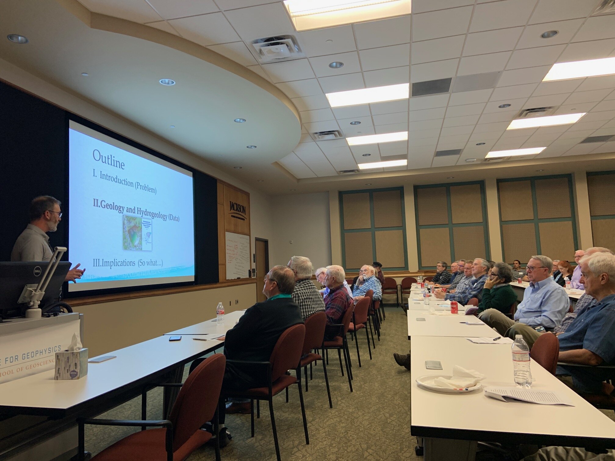
AGS meeting (Dec 7): Aquifer Storage and Recovery and Managed Aquifer Recharge throughout Texas: Planning for the Future

Aquifer Storage and Recovery and Managed Aquifer Recharge throughout Texas: Planning for the Future

Dr. James A. Golab, Hydrologist – Texas Water Development Board

Figure_TexasASR_AR.jpg

Key Points

Aquifer storage and recovery (ASR) is the process of storing water within aquifer strata for later recovery using an injection well. This water may be recovered from the same well the water was injected from or another location, depending on the project and local geology. Managed aquifer recharge (AR) is the intentional recharge of an aquifer by means of infiltration or injection. These methods have the benefit of reserving water during wet periods by preventing runoff and evaporation. In the 2017 State Water Plan, ASR and AR projects are estimated to comprise 1.8 percent of the new water supplies produced in Texas by 2070. In 2019, the 86th Texas Legislature passed House Bill 721 that directed the Texas Water Development Board (TWDB) to conduct studies to identify the relative suitability of aquifers for use in ASR and AR projects. This talk will present an overview of the current ASR and AR projects occurring across the state. 

Dr. James A. Golab

Dr. James A. Golab

Bio

James joined the Innovative Water Technologies Department at the Texas Water Development Board in 2019 and focuses on aquifer storage and recovery projects. James earned a Ph.D. in Geology from the University of Kansas, an M.S. in Geology from the Colorado School of Mines, and a B.S. in Geology from Mercyhurst University. James’ previous experience includes carbonate sedimentology and paleontology, recently completing his doctoral research on the Edwards and Trinity groups. James also has experience working in water utilities as a licensed treatment and production operator. 


View Event →
Nov
2
7:00 PM19:00

AGS Meeting (Nov 2): Waterborne gradient self-potential, temperature, and conductivity logging of Lake Travis, Texas

RSVP to ZOOM Event Here

Waterborne gradient self-potential, temperature, and conductivity logging of Lake Travis, Texas, near the Bee Creek Fault, March–April 2020

Scott Ikard, Hydrologist - USGS

Scott’s talk will focus on a geophysical pilot study of surface and groundwater exchanges between Lake Travis, Austin Texas, and the lower and middle zones of the Cretaceous Trinity aquifer. This study, performed in collaboration with Barton Springs Edwards Aquifer Conservation district, demonstrates the use of geophysical logging in surface-water bodies to quickly locate areas of enhanced hydrologic exchange between the surface-water and hydraulically connected aquifers. Continuous 31-kilometer long profiles of waterborne gradient self-potential, surface-water temperature, and surface-water conductivity at variable depths provide meaningful insight into unseen locations of hydrologic exchange between Lake Travis and the Trinity aquifer, which are consistent with the mapped hydrogeology and structural features along the profiles that influence hydrologic exchange.  

Scott Ikard, USGS

Scott Ikard, USGS

Biography

Scott is a licensed Professional Engineer and Hydrologist in the Geophysics and Subsurface Analysis unit of the United States Geological Survey's Oklahoma-Texas Water Science Center, in Austin, Texas. He holds a Ph.D. in Geophysical Engineering from the Colorado School of Mines, an M.E. in Geological Engineering from the Colorado School of Mines, and a B.S. in Geology from James Madison University.  Scott serves as Project Chief on applied research studies in geophysics and hydrogeology that broadly encompass development of research proposals, geophysical and hydrologic survey planning, instrumentation and data acquisition, and data processing and interpretation of airborne, waterborne, surface, and borehole hydrogeophysical data. His research interests include delineation and characterization of aquifer systems, forward and inverse geophysical and groundwater flow modeling, geophysical assessments of local and regional surface-water and ground water exchange patterns, and development of new geophysical surveying and processing approaches to hydrologic investigations.


View Event →
Oct
5
6:30 PM18:30

AGS Meeting (Oct 5): Halokinetic Influence on Carbonate Depositional Environments: An Example from the Fairway Field, East Texas Basin

RSVP to Zoom EVENT HERE

Halokinetic Influence on Carbonate Depositional Environments: An Example from the Fairway Field, East Texas Basin

Kelly Hattori, Geologist - Bureau of Economic Geology STARR Group

Kelly’s talk will focus on one example of a salt-influenced carbonate system, the James Limestone patch reef complex of the Fairway Field. Integration of core and wireline data with a regional understanding of paleotopography generated by salt movement sheds light on the architecture of the system and explains why James Limestone in the Fairway Field was (and remains) a great reservoir.

Kelly Hattori.JPG

Biography: Kelly is a carbonate stratigrapher in the Bureau of Economic Geology - STARR research group. Kelly holds a M.S. degree in Geosciences from the University of Texas at Austin and B.S. degrees in Geology and Marine Biology from the University of North Carolina at Wilmington. Her early research focused on sequence stratigraphy and paleoecology of coral reef systems, particularly with respect to global and local ocean perturbations such as ocean anoxic events and ocean acidification. She now broadly works Gulf Coast Cretaceous carbonates with a focus on “weird” systems such as mixed siliciclastic-carbonate environments, post-perturbation recovery patch reef complexes, and drowned platforms. She has built a specialty in salt-sediment interactions within the East Texas Basin that examine the sometimes-conflicting relationship between halokinesis and traditional sequence stratigraphy as well as the impact of halokinetic topography on carbonate depositional systems.

View Event →
Aug
31
6:30 PM18:30

AGS Zoom Ethics Meeting (Aug. 31) : Innovation Through Diversity and Inclusion

Innovation Through Diversity and Inclusion

By Skot Welch

Skot is the Principal/Founder of Global Bridgebuilders (GBB), a firm focusing on Organizational Development, Cultural Transformation and Inclusion. GBB bases its work in the core belief that inclusion is a business discipline and that it should be leveraged across all that the enterprise does. To gain this leverage, GBB applies a continuous improvement model, anchored in metrics. Skot's talk will discuss the business imperative for companies to understand the importance of diversity and inclusion.

Skot has been a global bridge builder long before he founded the company in 2006. Growing up in a military family gave Skot a unique perspective on diversity that he still carries and a passion for helping organizations tap into the vast experiences of their employees to create stronger businesses. Skot has worked in international business and Diversity/Inclusion management for nearly 20 years and has developed an in-depth knowledge of diversity, inclusion and workforce development that brings together and maximizes the perfect blend of people and process. Prior to the launch of Global Bridgebuilders, Skot served as Vice President of Business Development and Benchmarking Services for DiversityInc magazine in New Jersey, where he worked with many of the Fortune 500’s biggest global brands across a broad range of industries.

Skot Welch, Principal/Founder of Global Bridgebuilders (GBB)

Skot Welch, Principal/Founder of Global Bridgebuilders (GBB)

Books that Skot has authored and co-authored include: 101 Ways to Enjoy The Mosaic, Creating a Diverse Community Right in Your Own Backyard; Plantation Jesus; and The Ross School of Business - University of Michigan: Diversity Management as a Generative Strategic Process: When the Business Case Meets Positive Organizational Scholarship;

Please RSVP using the link here.

This event is for AGS members. please consider renewing your membership using PayPal

You must have a Zoom account to join this meeting.

UT participants may login at utexas.zoom.us with UT-EID/password

Guests may register for a free account at zoom.us

View Event →
Jun
1
7:00 PM19:00

AGS ZOOM Meeting (June 1): Seismicity in Texas - What have we learned from reporting seismicity and applied seismicity research?

**PLEASE NOTE THAT THIS IS A ZOOM (ONLINE) MEETING ONLY. CHECK YOUR EMAIL FOR DETAILS. Meeting will begin at 7pm, but members can log in starting at 6pm to address issues.

Seismicity in Texas - What have we learned from reporting seismicity and applied seismicity research?

Alexandros Savvaidis

Abstract:

It is evident that in the south US mid-continent the seismicity currently reported is primarily related to oil and gas operations. In Texas, although the recorded earthquakes are of low to moderate magnitude, the rate of seismicity has been increasing since 2009. The TexNet Earthquake Observatory has catalogued 2000 M1.5+ earthquakes in Texas since January of 2017 occurring primarily in the Fort Worth Basin, the Eagle Ford play area of south Texas, and across the greater Permian Basin region, especially in the Delaware Basin.

Our research efforts have collected and compiled information on oil and gas operations including wastewater disposal (SWD) and are able to associate them with seismicity in parts of the State. In other areas we are able to develop strong spatiotemporal statistical linkages between the recent increase in seismicity rate and hydraulic fracturing operations (HF). However, although there are still areas that the causal factor(s) of seismicity is unclear we work on integrating all available data to understand and mitigate seismicity in Texas and therefore work on sustainability of our shale resource development.

ALEXANDROS SAVVAIDIS

ALEXANDROS SAVVAIDIS

Biography

Manager and Seismology Research Team Lead of the Texas Seismological Network (TexNet) and Center for Integrated Seismicity Research (CISR). Extensive 20 years experience in Ap- plied Geophysics and Engineering Seismology both through my research position as a Senior Researcher and collaboration with Industrial partners in multidisciplinary European and US funded projects. In addition, I managed the largest Seismographic Network in Greece, num- bering 100 real time accelerometers and 150 offline installations. My research activity and technical expertise is focused on, engineering seismology, Earth observation and disaster risk reduction, exploration, engineering, and environmental geophysics. My research on Seismology includes the study of source characteristics, the wave path and site characterization in case of an earthquake event, the real time acquisition of ground motion data, for earthquakes of tectonic or volcanic activity, Shakemaps implementation and data fusion for disaster risk mitigation. Additionally in Applied Geophysics my attention is directed towards acquiring, processing, and modeling geophysical data using passive and active seismic and electromagmetic techniques in urban and free field areas to reveal 1D, 2D and 3D earth models and to improve the knowledge in exploration, mining and three dimensional basin structure using geophysical methods. Also, I am an expert of surface wave data acquisition, processing and inversion for crustal modeling. For this I have applied different inversion algorithms through the Texas Advanced Computing Center (TACC) in passive and active data in order to minimize the computational time.


View Event →
May
4
6:00 PM18:00

AGS Meeting (May 4): CANCELLED

CANCELLED DUE TO ONGOING PANDEMIC

Catastrophic floods and temporal increases in catastrophic floods in Central Texas

Raymond Slade, Jr.

Abstract

Catastrophic-flooding threats are arguably as severe in Central Texas as anywhere in the country. Many of the largest storms produce catastrophic flooding thus deeming the area to be “Flash Flood Alley”.  The area is characterized by fast-developing intense storms, some of which have produced world-record rainfall depths.  Also, geographic characteristics such as thin soils and steep land slopes contribute substantially to the flooding.  However, perhaps the most substantial flooding threat is from easterly moving storms which often follow basin orientation—such storms can overlie and move with channel flooding thus causing immense increases in downstream flood peaks.  Nevertheless, floods are merely a hazard—mankind is the disaster.  For example, the area often leads the nation in drowning deaths and flood-damage costs--about 300,000 people reside within the 100-year floodplain in the five-county IH 35 cooridor from Williamson to Bexar County.

Additionally, climate change likely is increasing the flooding threat.  For example, linear temporal-trend analyses of data for all 14 long-term NOAA hourly rainfall gages in Central Texas indicate annual-maximum 6-hour storm depths to have increased by a mean value of 19 percent during the past 60 years.  Most of the increases are deemed to be statistically significant at the 90-percent confidence level.  Also, analyses of data for all 19 gages in the area infer annual-maximum 2-day storm depths to have increased by 16 percent over the past 70 years.  Even small increases in large storm depths can cause large increases in peak discharges because, for such storms, most of the increased rainfall becomes runoff rather than ground infiltration or basin attenuation. For example, analyses of data for 15 long-term streamflow gages in the area document annual-peak discharges to have increased by a mean value of 72 percent during the past 60 years.  Analyses of the largest of the annual-peak discharges indicate such peaks to have even greater increases.  Finally, based on the trend analyses, the flooding threat in Central Texas is expected to increase even more in the future.

photo_slade.JPG

Biography

Before retiring, Raymond Slade, Jr. served as a Hydrologist for 33 years with the U.S. Geological Survey (USGS) in Texas.  He has authored about 200 reports or presentations on the hydrology and water quality of surface and groundwater in Texas, with emphasis on the Edwards aquifer, floods, and droughts.

Since his retirement from the USGS he has been an Adjunct Professor and a self-employed Consulting Hydrologist.  He is Certified and Registered as a Professional Hydrologist with the American Institute of Hydrology.  Raymond is a member of eight water-resource related professional organizations and has served on about 20 committees related to water-resource planning or management.

View Event →
Mar
2
6:00 PM18:00

AGS Meeting (Mar 2): Hydrogeology of Western Travis County

Hydrogeology of Western Travis County

by Brian Hunt and Lane Cockrell

Photos above: Lane Cockrell and Brian Hunt present at AGS.

Abstract
The Hill Country Priority Groundwater Management Area (PGMA) was designated in 1990 in response to existing and projected groundwater availability issues within the Trinity aquifers. Anecdotal reports suggest current groundwater availability issues in the Southwestern Travis County (SWTC) portion of the PGMA. In the absence of a groundwater conservation district, the area’s hydrogeology remained poorly characterized and pumping and aquifer conditions were largely unmonitored. This study presents a compilation of existing and new hydrogeologic data to develop a better understanding of groundwater resources in SWTC.

Water level and geochemical data indicate that the Bee Creek and Mount Bonnell faults are important structural features restricting regional groundwater flow. Fieldwork, borehole geophysics and drill cuttings suggest that clastic input from the Llano uplift influenced carbonate facies and unit thicknesses, and reduced primary porosity and permeability within the Middle Trinity aquifer. Fault-impeded recharge, reduced porosity and increased pumping have combined to reduce water levels in the Middle and Lower Trinity aquifers by hundreds of feet over the last 40 years. Water levels in Lower Trinity monitor wells have consistently declined up to 3 ft/yr, indicating that groundwater mining is occurring. Historic Middle Trinity wells have become unusable in portions of SWTC due to water level declines, and new wells typically target the Lower Trinity aquifer. Over 2000 wells were drilled in SWTC since 2003; of these, over 70% target the Lower Trinity. We estimate that 1.4 billion gallons of groundwater is pumped per year in SWTC, of which 60% is from the Lower Trinity. This is in contrast to neighboring Hays County, where the Middle Trinity is fully saturated and is the primary groundwater source. These evaluations corroborate the designation of the study area as a PGMA and underscore the need for groundwater management and further study. The Hydrogeologic Atlas has refined the area’s hydrogeologic framework and conceptual model, established current aquifer conditions, and estimated groundwater use in SWTC. These data will provide a baseline for future groundwater studies of the region and help inform strategies and policies to manage and protect the region’s groundwater resources.

Lane Cockrell (standing) records water-level data collected by team member Robin Gary.

Lane Cockrell (standing) records water-level data collected by team member Robin Gary.

The talk summarizes a cooperative study between the Barton Springs/Edwards Aquifer Conservation District and Travis County that focused on the hydrogeology of western Travis County. The product of the study will be a technical document we are calling a hydrogeologic atlas. The atlas and data will be provided to the public for free when published, we anticipate sometime in February 2020. This abstract will be given at the Geological Society of America South-Central Section - 54th Annual Meeting - March 2020, Fort Worth, Texas.

Learn more at the project website.

Recent newspaper article: Austin American Statesman article.

View Event →
Feb
3
6:00 PM18:00

AGS Meeting (Feb 3): Early Human Interactions and Migrations – Three Mysteries

Early Human Interactions and Migrations – Three Mysteries

Neil Bockoven, PhD

Abstract

Mystery One:  Neanderthals lived in Europe for more than 250,000 years.  When we (Homo sapiens) arrived on the scene about 45,000 years ago, they disappeared quickly – forever.  What happened? Five major factors played a role in the Neanderthal demise: 1) Homicide by modern humans, 2) Disease brought by modern humans, 3) Competition for food and resources, 4) Our larger population absorbed their smaller one, and 5) Climate change brought on by the Campanian Ignimbrite eruption.

Mystery Two:  Did we mate with Neanderthals and have viable offspring? If so, what genetics did we get from them?  Yes, but only interbreeding between modern human males and Neanderthal females seems to have produced viable offspring. From the Neanderthal genes we got enhanced viral immunity, but also predispositions for ailments such as lupus, Crohn’s disease, type 2 diabetes, actinic keratosis, and depression.

Why is an Australian aborigine more genetically similar to a Scandinavian than an African tribesman is to a member of a different African tribe?  A small subset of the African population (with their relative lack of genetic diversity) left Africa about 70,000 years ago, and they populated the rest of the world.

In addition to answering these and other intriguing questions, we’ll discuss the huge breakthroughs coming from ancient DNA analysis, and the different information we get from the three types of DNA.

Neil Thomas Bockoven

Neil Thomas Bockoven

Biography

Neil Thomas Bockoven is an award-winning PhD geologist and journalist with 35 years of experience in minerals exploration. He has been featured in: Geological Society of America Bulletin, Association of Petroleum Geologists Bulletin, Virginia Journal of Science and many other scientific publications. He has appeared multiple times on several popular radio talk shows to discuss a variety of science-based subjects and his books. Neil is a member of the Archaeological Institute of America, the Archaeological Conservancy, and is an Impact Member of the Center for Study of the First Americans. Neil worked as a geologist for Exxon/ExxonMobil in Denver, Midland, Houston, New Orleans and Albuquerque. He coordinated dozens of joint ventures with oil and gas companies, including rights to the entire King Ranch in Texas. Neil attended The College of William and Mary, where he was a member of the state champion swim team, and received a Bachelor of Arts. He went on to The University of Texas at Austin, earning a masters and doctorate. He has published articles on topics as diverse as the geology of huge volcanic calderas of the Sierra Madre Occidental Mountains of Mexico to sexual dimorphism in Astarte clams. His current interests center on the interaction between Early Modern Humans and Neanderthals during the Paleolithic Age, and the amazing related discoveries being made through archaeology and genetics. In addition to Moctu and the Mammoth People, Neil also has published a related children’s book titled When We Met Neanderthals.

click here to learn more about the books


View Event →