Nov
4
6:30 PM18:30

Inner structure of Pilot Knob volcano revealed by high resolution resistivity tomography and magnetic surveys, Austin, Texas

Mustafa Saribudak, Ph.D., P.G.

RSVP to AGS Meetings HERE

Mustafa Saribudak is the principal of Environmental Geophysics Associates (EGA). He holds B.Sc. and M.Sc. (1975) in geology from the University of Istanbul and a Ph.D. (1987) in geophysics from the Istanbul Technical University in Turkiye. He came to the University of Houston in 1990 as a visiting geoscientist to work on a National Science Project. Then he started working for an environmental company in the Woodlands between 1991 and 1993, where he pioneered the application of geophysical methods to environmental problems. He founded EGA in 1994 to provide near-surface geophysical services for engineering, environmental, and oil and gas industries, and real estate developers. Since than he has worked on more than 400 projects across the North and South Americas. His research interests have been, aside his ongoing business projects, the active growth faulting in the Houston area, major faults and karstic features of the Edwards Aquifer (caves and sinkholes). His current curiosity has been the application of geophysical methods to volcanoes.

View Event →
Oct
7
6:30 PM18:30

Where the river meets the rising sea: the interface of the Woodbine and Eagle Ford in north and central Texas

Dr. Richard Denne, Hunter Enis Endowed Chair in Petroleum Geology at TCU

RSVP to AGS Meetings HERE

Richard Denne is the founding chairholder of the Hunter Enis Endowed Chair in Petroleum Geology at TCU and the former Director of the TCU Energy Institute. Richard worked as a geologist in the oil and gas industry for over 25 years, working with integrated teams at Exxon and Marathon Oil and as a consultant in exploration and production from deep-water basins across the globe, including the Gulf of Mexico, West Africa, Brazil, Trinidad, and the North Sea. He has also been heavily involved in unconventional shale plays, particularly the Eagle Ford of Texas.  He has been at TCU since 2016, where his current research is focused on depositional systems of organic-rich rocks, especially those from the Cretaceous of Texas and the Eagle Ford / Woodbine system in particular.

View Event →
Aug
26
6:30 PM18:30

Should ChatGPT Write It with Me? Ethical AI Ambiguity in Education and Research

Joel Johnson, Ph.D., Associate Professor in Earth and Planetary Sciences at UT Austin

RSVP to AGS Meetings HERE

Dr. Joel Johnson is an Associate Professor in Earth and Planetary Sciences at UT Austin, and a geomorphologist who focuses on fluvial processes.  He got his PhD from MIT in 2007, and has been at UT since 2009.  His research focuses on quantifying active surface processes and relating them to the evolution of topography over both short and long timescales. Research topics include quantifying how climate gradients and bedrock properties influence topographic development, understanding controls on tsunami and storm surge deposition, and constraining feedbacks between sediment transport rates, sediment sorting, vegetation and the evolution of bed roughness in mountain rivers.  In addition, he has taught an undergraduate course in geoethics for several years, and enjoys discussing questions of values on which reasonable people can disagree.

View Event →
Jun
3
6:30 PM18:30

Continuing Physical Hydrogeological Studies of Recharge to Balmorhea-area Springs, TX

Rebecca Smyth, M.A., P.G., Bureau of Economic Geology, UT-Austin

RSVP to AGS Meetings HERE

Rebecca C. “Becky” Smyth is now a part-time retiree at UT Austin BEG. She grew up in Dallas, TX and Richmond, VA, earning a B.S. in Geology from Va. Tech (Go Hokies!) in 1980. She returned to Dallas via the Big Apple to work in Core Laboratories Petrology Division, but moved back to Austin within a few years. Here she tried becoming a chemist and took graduate classes in geology while working two part-time jobs (BEG and USGS Water Resources). In 1985 she and geologist-husband moved in with military family in England then took to the road in a VW van for 1.5 years across western and eastern Europe, Scandinavia, and USSR, ending up as farm laborers in Israel for three months. Back in Austin again, Ms. Smyth went to work in groundwater consulting then earned a Master’s in Geology at UT Austin (Hook ‘Em) in 1995 (“Porosity and Permeability Controls in the Santana Ash Flow Tuff, Trans-Pecos Texas”); darling Joanna was 4-yrs old by then. Back at BEG from 1997 through 2017, she investigated lands impacted by oil and gas production (1997-2000), airborne laser mapping (lidar) (2001-2006), and geologic CO2-sequestration (2007-2017). In 2018 she returned to BEG part-time to work on the Balmorhea-area springs project, and a few other water-related studies (TCEQ, Travis County).

Abstract

Trans-Pecos Texas is dryer now than it has been since the early aughts and beyond. Fortunately, many of the springs along the north side of the Davis Mtns, between Ft. Davis and Pecos, TX are still flowing, albeit less than they were when the U.S. Geological Survey (USGS) began reporting on them in the 1930s-1940s. Since the start of BEG research in 2018, the only significant rainfall in the region was in Fall 2022. By significant rainfall I mean an amount needed to affect brief, but measurable “freshening” in the pool at Balmorhea State Park in Toyahvale, TX. An example of freshening of pool water from >2,000 milligrams per liter total dissolved solids (mg/L TDS), almost down to drinking water standard of 500 mg/L TDS, came after multiple 1-2-inch regional (~5,000 mi2) rainfall events between August and November 2022. From whence the rainfall comes that is recharging one of the five (maybe six) candidate aquifers that are thought to contribute flow to the Balmorhea-area springs is still being studied. Great work by Jack Sharp and students, and the Texas Water Development Board, among others has been helping answer the question: Can existing and future industrial scale production of groundwater take place without more seriously impacting spring flow discharge? We at BEG, and others, think more work is needed.

View Event →
May
6
6:30 PM18:30

The Power of Applied Geophysics - Rusty Branch

Rusty Branch, P.G., R.G., Vice President and Senior Geoscientist, Gehrig, Inc.

Rusty is a geologist and geophysicist and has been a member of the Gehrig, Inc. team since 2016. He has over 16 years of experience in the field of near-surface, applied geophysics, including UAV-based studies. He has served on many local, state, and national boards and committees of professional organizations and non-profits. Some of the positions include Chair for the Texas Section of the ASCE Geo-Institute, Chair of the Texas Chapter and national board member of the Association of Environmental and Engineering Geologists (AEG), and a leadership instructor on the local, regional, and national level for the Boy Scouts of America. He has authored and co-authored peer-reviewed publications in the fields of geology, vertebrate paleontology, and botany and he is an avid birder. His three decades of professional and academic experience cover geoscience, bioscience, computer information systems, and GIS. Rusty has a B.S. in Geoscience from Tarleton State University, a M.S. Biology (Vertebrate Paleontology) from Baylor University, and a M.B.A from University of Texas at Arlington.

Abstract

What is the true power of applied, near surface geophysics? Two decades ago, this subfield was in its infancy and not extremely popular. Since then, it has gained acceptance as a viable value-add for many hydrogeology, environmental and engineering projects. During this presentation I will review a series of interesting, recent case histories that illustrate the true power of applied geophysics. We will wrap things up with a short glimpse into the future of applied geophysics.

View Event →
Apr
1
6:30 PM18:30

Revisiting Gunnar Brune's "Major and HIstorical Springs of Texas:" Have We Lost More Springs Over the Past 50 Years?

Robert Mace, Ph.D.

Robert Mace is the Executive Director and Chief Water Policy Officer of The Meadows Center for Water and the Environment and a Professor of Practice in the Department of Geography at Texas State University. Robert has over 30 years of experience in hydrology, hydrogeology, stakeholder processes, and water policy, mostly in Texas. Robert has a B.S. in Geophysics and an M.S. in Hydrology from the New Mexico Institute of Mining and Technology and a Ph.D. in Hydrogeology from The University of Texas at Austin.

RSVP to AGS Meetings HERE

View Event →
Mar
4
6:30 PM18:30

Poster Session - In Person Only

RSVP to AGS Meetings HERE

Location

BEG Library
BEG Main Building, Building 130 
UT Austin, JJ Pickle Research Center
10100 Burnet Rd., Bldg 190
Austin, Texas 78758
Bureau Directions and Maps | Bureau of Economic Geology

Timeline

Meeting Time: 6:30 - 8:10 PM
Set Up and Refreshments: 6:30 to 7:00 PM
Student Recognition and Introductions: 7:00 PM
Browsing and Discussions: 7:15 to 8:00 PM

View Event →
Feb
5
6:30 PM18:30

Undergraduate Research Session

Madison is a senior at the University of Texas at Austin double majoring in Environmental Science, Geological Sciences and Environmental Engineering. For the last year, she has been conducting research for her honors thesis in the Jackson School Undergraduate Honors Research Program under the supervision of Dr. Toti Larson at the Bureau of Economic Geology. Her research focuses on how hydrogen gas is consumed by microbes during storage in porous reservoirs. After graduation in May, Madison plans to attend the University of California, Berkeley for a Masters in Geosystems Engineering.  

Abstract:

Renewable hydrogen energy is made possible through the storage of large quantities of hydrogen gas in salt caves and potentially in porous subsurface media. Hydrogen is injected into subsurface reservoirs where it displaces existing fluids, typically brine, oil, or natural gas, and spreads under an impermeable caprock to prevent leakage. Due to hydrogen being such a novel energy resource, there are several concerns and possible limitations associated with large-scale storage. Hydrogen is unstable as a liquid, so it must be stored as a gas; however, natural porous media such as aquifers, salt caverns, and oil or gas reservoirs host diverse microbial communities as deep as several kilometers into the subsurface. While previous studies have been conducted on the future of hydrogen energy, few analyses have been done on the behavior of hydrogen gas in the subsurface, and even fewer investigate the interaction between hydrogen and microbes. This research project focuses on examining the microbial consumption of hydrogen gas in a system able to store excess energy in a porous reservoir (HSPR). Ultimately, this work aims to monitor hydrogen consumption over time and determine the driving biogeochemical reaction pathways that occur in the presence of microbes. 

By monitoring hydrogen consumption using Wilcox core, it was concluded that iron-reducing bacteria are the most prevalent microorganism in the system, which produce ferrous iron while depleting hydrogen. The iron-stained sandstone resulted in more hydrogen being consumed than quartz sandstone; however, hydrogen consumption occurs at relatively slow rates on the scale of 105 nM/hr. Abiotic samples proved that in the absence of microbes, little to no hydrogen is lost in comparison to biotic samples. These novel data will contribute to quantifying the difference in hydrogen depletion between quartz sandstone and iron sandstone reservoirs as well as provide a deeper understanding of the reactivity of hydrogen gas in fluids containing abundant microbial communities. 

James Sun

James is a 4th year undergraduate student studying geology at the University of Texas at Austin. James has enjoyed working as an undergraduate research assistant over the past couple of years on various projects. For his honors thesis, James is working under Dr. James Gardner (Supervisor) and Wade Aubin (Graduate Supervisor) studying the kinetics of heterogeneous bubble nucleations. After graduation, James plans to attend Colorado School of Mines to pursue studies in economic geology. 

Abstract:  

The exsolution of dissolved gasses from magmas drives volcanic eruptions. These gasses exsolve by forming gas bubbles in response to decreasing magmatic pressure. Bubbles nucleate from silicate melt either homogeneously or on preexisting surfaces, such as crystals. Heterogenous nucleation is considered favorable because it has a much lower energy barrier than homogenous nucleation, and natural magmas are rarely free of crystals. Despite the importance of heterogeneous nucleation, little is known about how it varies with differing numbers and sizes of crystals in silicic melts. We are conducting an experimental campaign designed to constrain the factors that influence heterogeneous nucleation of bubbles in silicic magmas. We are conducting temperature, pressure, and time-controlled experiments using samples prepared with known numbers and sizes of crystals. Samples with different number densities of crystals of a given size will enable us to determine how bubble number densities relate to crystal abundances. 

Samples with varying sizes of crystals will allow us to recognize how nucleation sites (crystal faces, tips, corners) become important with changing decompression conditions. Samples with known crystal concentrations but different melt compositions (rhyolite-trachyte-phonolite) will enable us to discern whether heterogeneous nucleation behavior differs across the spectrum of silicic magma types. When combined with our understanding of homogeneous nucleation, this study will help to construct a more complete model for bubble formation that will elucidate the interplay between heterogenous and homogenous nucleation in erupting silicic magmas. 

David Keith 

David is a senior in the Jackson School of Geosciences Undergraduate Honors Research Program double majoring in Geosystems Engineering and Hydrogeology and Environmental Science, Geology. David was born in Austin and grew up a lifelong Longhorn but spent most of 

his life living in Boerne, outside San Antonio. David is working with Professor M. Bayani Cardenas within the Jackson School and their research focuses on measuring the thermochemical properties of Lake Travis and assessing the impact that recent drought and climate change may have had on the behavior and magnitude of lake stratification typically experienced there. David has recently accepted a full-time position within Occidental Petroleum’s Engineering Development Program as a Production Engineer and looks forward to working on projects modernizing the energy industry. Outside of work and education, David is a passionate outdoorsman, reader, and cinephile and is going to particularly enjoy watching Texas beat A&M in the SEC next year.  

Abstract:  

Lake stratification is an important process affecting the biogeochemical characteristics of inland lakes throughout the year. Lakes play a critical role in supporting inland life across the globe, providing a source of food, drinking water, biodiversity, and shelter to untold organisms and supporting millions of distinct ecosystems across the Earth. Consequently, understanding the stratification patterns of inland lakes is pivotal to understanding the health of nearby ecosystems and communities. Lake Travis, located outside Austin, Texas, is one of seven freshwater reservoirs in Central Texas collectively known as the Highland Lakes and is the sole source of drinking water for the city of Austin. In the face of anthropogenic climate change and worsening drought, a clear understanding of Lake Travis’ seasonal stratification pattern and its reaction to climatic change is needed to protect and preserve the surrounding communities. Vertical profiling of Lake Travis’ temperature, pH, dissolved oxygen, dissolved carbon dioxide, and specific conductivity, and turbidity—achieved via regular scuba dives over a 12-month period from October 2020 to October 2021—revealed that Lake Travis is a monomictic lake, meaning that it experiences a complete turnover only once a year. During stratification, a lake separates into an upper and lower layer, known as the epilimnion and hypolimnion, respectively. Thermal stratification of Lake Travis appears to occur during summer months, from April to November, while a separate chemical stratification appears to occur during the winter turnover period, from December to March. Time series of each chemical data set data show that during stratification, the rate of carbon cycling increases within the hypolimnion, accompanied by an acidification and accumulation of CO 2 . Vertical profiling dives of Lake Travis resumed in February 2023 in order to characterize the lake stratification pattern under severe drought conditions and draw comparisons to the 2020/2021, pre-drought pattern. 

Mercedes Jordan

Mercedes Jordan is a first-generation geophysics (B.S.) honors student at the University of Texas at Austin’s Department of Earth and Planetary Sciences and an undergraduate research assistant at the University of Texas Institute for Geophysics. Mercedes’ research involves radar reflectometry, with current work focused on calibrating surface reflectivity from Kaguya’s Lunar Radar Sounder data using laboratory measurements of permittivity. During her time at UT, Mercedes has been recognized as a college scholar at the top of her class and has participated in the Undergraduate Honors Research Program. Mercedes hopes to pursue a doctoral degree in geophysics with a focus on planetary research following the completion of her undergraduate degree. 

Abstract:

The Lunar Radar Sounder (LRS) instrument aboard the Kaguya spacecraft collected extensive radar data during its mission, yet its utility for geologic interpretation was limited by its relative power scaling. Laboratory measurements of permittivity from recently collected Chang’E-5 samples allow for an estimation of the reflection coefficient at the landing site, allowing for an absolute calibration of Kaguya's LRS surface reflectivity. Focused on the Procellarum KREEP Terrane (PKT) region, this study aims to revitalize the LRS dataset, providing a more robust understanding of lunar surface materials within the first 50-75 meters of depth. Given PKT’s lack of rough and sloped terrain, it provides the perfect location for conducting absolute calibration of the signal through radar statistical reconnaissance (RSR) as most of the signal is coherent and specular. The methodology involved extracting surface reflectivity, fitting a distribution of amplitudes near the CE-5 landing site to a Rice probability density model, computing a gain correction factor, and applying this correction factor to the entire dataset. Preliminary results depict three distinct facies in the PKT region, associated with varying degrees of reflectance power. However, these heterogeneities in reflectance cannot be solely explained by surface geology as we see facies transition within the bounds of both mare basalt units. Mapping TiO2 abundance, FeO abundance, and roughness reveals dependencies on ilmenite content, with TiO2 showing a significant correlation with radar surface reflectivity. 

View Event →
Dec
4
6:30 PM18:30

Mapping fracture networks in outcrop analogs: length, aperature & connectivity, and the role of contingent nodes

Stephanie Forstner

RSVP to AGS Meetings HERE

Stephanie is a final year Ph.D. candidate in Geosciences at UT Austin specializing in Structural Geology and Tectonics. She holds a BA in Geology from Fort Lewis College. Before her role as Research Scientist Associate II with BEG’s Fracture Research Application Consortium, Stephanie owned and operated her own oil and gas and CO2 exploration consulting firm for a handful of years. Her expertise lies in fracture network assessments and structural diagenesis, supported by her proficiency in SEM imaging and fluid inclusion analysis. Notably, her first first-author paper ­– Scale-dependent fracture networks – co-authored with PhD advisor, Dr. Steve Laubach, ranked in the Journal of Structural Geology’s top 8 most downloaded papers (for the previous 90 days) for most all of 2023. She is currently seeking post-grad school opportunities in research, exploration and development within the energy sector.

Abstract:

Using examples of regional opening-mode fractures in sandstones from the Cambrian Flathead Formation, Wyoming, we show that quartz deposits preferentially fill fractures up to ca. 0.05 mm wide and fractures transition from being mostly sealed to mostly open over a narrow size range of opening displacements from 0.05 to 0.1 mm. In our example, although isolated (I-node) dominated networks have some trace connectivity, the effective connectivity for fluid flow is likely greatly reduced by quartz cementation. Trace connectivity at microscopic and outcrop scale is similar, but most porosity is found in outcrop-scale fractures. Near faults, trace connectivity increases as initially wide porous fractures preferentially shear and wing cracks form, increasing fracture intersections (Y-nodes). However, pore space is lost due to the development of microbreccia. Macro-scale trace connectivity increases, but porous connectivity diminishes and thus potential for fluid flow is markedly lower. Connectivity descriptions should include accurate measures of widths and lengths and use nodes that reflect scale and diagenesis. We propose new rule-based node descriptions to measure diagenesis sensitive connections within the context of current field practices. Under diagenetic conditions between ca. 50˚C–250˚C differential infill makes network porosity, and thus permeability and strength, scale dependent. 

View Event →
Nov
6
6:30 PM18:30

Texas Seismicity and Seismotectonics

Currently a seismologist affiliated with the Texas Seismological Network. Have a master degree
in Marine Geophysics from the National Taiwan University and PhD in Geophysics from the State
University of New York at Binghamton. Research interest includes studying seismotectonics of
subduction zone and intraplate seismicity. Prior to the employment at the BEG, have several years of research and development experiences from the Oil & Gas industry, focusing on induced seismicity.

Abstract:

Earthquake activities in the State of Texas have significantly increased since 2008. The statewide Texas Seismological Network, better known as TexNet, was established in response to the increased seismicity and for enhancing the earthquake monitoring capacity. Studies have suggested that recent seismicity in Texas are associated with oil&gas industrial activities. Over time, seismic events were unevenly distributed throughout Texas, which have revealed previously unknown seismogenic structures across the state. Currently, a number of seismogenic zones have been identified in the greater Permian Basin (West Texas), the EagleFord Shale Play (the coastal Texas), the Fortworth Basin (central Texas), as well as several minor clusters. Earthquakes in these seismogenic zones present various rupture patterns, largely reflecting the architecture of pre-existing basemnt-rooted tectonic faults. In this presentation I will give a brief summary of these seismogenic patterns.

View Event →
Oct
2
6:30 PM18:30

The Geology of Western Sicily and Its Effect on Iron Age (2800-2900 BP) and Modern Societies

John Berry was President of the AGS in 2016-17, and is a Texas P.G.

He was Editor of The Professional Geologist (AIPG house magazine) 2017-2021. His interests include the geology of the southern Appalachians, the genesis of stratabound base metal deposits and of seepage in frontier hydrocarbon prospecting. For several years he has been helping a Swedish archaeologist to understand the interaction between the human societies of western Sicily and the area’s complex and rapidly evolving geology.

Abstract:

Western Sicily is underlain by African basement upon which is piled a series of south-verging thrust sheets (the Maghrebian Orogenic Belt) containing rocks as young as early Pleistocene.  Uplift and large earthquakes continue to the present.  Sediment loads of rivers are high, resulting in extensive alluvial plains: these were historically highly malarial, but are now drained and being de-watered by intensive irrigation. Iron Age settlements were often on the summits of high mountains, as were Arab settlements.  At other periods settlements have clustered in or near the fertile but unhealthy plains. Our project seeks to develop cheaper, more effective techniques of archaeological survey using modern remote-sensing tools. We also hope to elucidate the opportunities and limitations placed upon Iron Age and later societies by the geology of their surroundings.

View Event →
Aug
28
6:30 PM18:30

Ethics and Geoscience Practice in Texas (Video)

Mark N. Varhaug, P.G., C.P.G., TBPG, AAPG, Beacon Hill Energy President

RSVP to AGS Meetings HERE

Biography:

Mark N. Varhaug, P.G., C.P.G., of Dallas, serves as an appointed member of the Texas Board of Professional Geoscientists where he is Secretary/Treasurer of the Board and chairs the Application Review and Continuing Education Committee. He is also Secretary of the Southwest Section of the AAPG. Mark has more than forty-five years’ experience in the practice of geoscience in the US and internationally. He is currently President of Beacon Hill Energy, an independent exploration firm in Dallas.  

Mark received a Bachelor of Science in geology from Southern Methodist University. He is a Licensed Professional Geoscientist in Texas and Louisiana and an AAPG C.P.G.  He is a member of the Dallas, Houston, and West Texas Geological Societies; the Geological Society of America; and is a Life Member of the Society of Petroleum Engineers.  

View Event →
Jun
5
6:30 PM18:30

The Origin of Modern Atolls

The Origin of Modern Atolls: Challenging Darwin’s Deeply Ingrained Theory (Video)

RSVP to AGS Meetings HERE

Prof. Andre Droxler, Ph.D., Emeritus Professor
Dept. of Earth, Environmental and Planetary Sciences, Rice University

Description

In 1842, Darwin identified three types of reefs: fringing reefs, which are directly attached to volcanic islands; barrier reefs, which are separated from volcanic islands by lagoons; and ring reefs, which enclose only a lagoon and are defined as atolls. Moreover, he linked these reef types through an evolutionary model in which an atoll is the logical end point of a subsiding volcanicedifice, as he was unaware of Quaternary glaciations. 

As an alternative, starting in the 1930s, several authors proposed the antecedent karst model; in this model, atolls formed as a direct interaction between subsidence and karst dissolution that occurred preferentially in the bank interiors rather than on their margins through exposure during glacial lowstands of sea level. Atolls then developed during deglacial reflooding  of the glacial karstic morphologies by preferential stacked coral-reef growth along their margins. 

Here, a comprehensive new model is proposed (Droxler and Jorry, 2021), based on the antecedent karst model and well-established sea-level fluctuations during the last 5 million years, by demonstrating that most modern atolls from the Maldives Archipelago and from the tropical Pacific and southwest Indian Oceans are rooted on top of late Pliocene flat-topped banks. The volcanic basement, therefore, has had no influence on the late Quaternary development of these flat-topped banks into modern atolls. During the multiple glacial sea-level lowstands that intensified throughout the Quaternary, the tops of these banks were karstified; then, during each of the five mid-to-late Brunhes deglaciations, coral reoccupied their raised margins and grew vertically, keeping up with sea-level rise and creating the modern atolls. 

Recent computer based 3D numerical simulations by Liu et al. (2022) on the Quaternary development of Meiji Atoll in the southern South China Sea, based on interpreted data from a 2020-m-deep borehole drilled on its northeast rim in 2018, show that spatially differential dissolution across margin and interior areas is a critical driver of worldwide central lagoons and atoll formation.

View Event →
May
6
8:30 AM08:30

Geology Paddle on Lady Bird Lake

Please let us know if you plan to join the AGS paddle trip on Lady Bird Lake on Saturday, May 6. Participants will meet at the Rowing Dock (2418 Stratford Drive, Austin TX, 78746). Folks are welcome to bring their own boats and put in at the shore next to Rowing Dock, or rent from Rowing Dock. Meeting time will be at 8:30 am, and the dock opens at 9. There is a small dock to the side of the Rowing Dock for those who bring their own boats. Rowing Dock's rental prices are $45/day for a kayak, and $55/day for a stand-up paddle board (SUP).

Please use this survey to let us know if you plan to attend and whether or not you will need to rent a kayak from the Rowing Dock.

We are asking for a $25 per person fee to help pay for a guidebook that will be provided to attendees.

View Event →
May
1
6:30 PM18:30

Poster Session - In Person Only

Location

BEG Library
BEG Main Building, Building 130 
UT Austin, JJ Pickle Research Center
10100 Burnet Rd., Bldg 190
Austin, Texas 78758
Bureau Directions and Maps | Bureau of Economic Geology

Timeline

Meeting Time: 6:30 - 8:10 PM
Set Up and Refreshments: 6:30 to 7:00 PM
Student Recognition and Introductions: 7:00 PM
Browsing and Discussions: 7:15 to 8:00 PM

View Event →
Apr
3
6:30 PM18:30

Geoheritage & UT Seniors

RSVP to AGS Meetings HERE

Geoheritage in Texas

Geoheritage sites are areas of geologic features with significant scientific, educational, cultural, and/or aesthetic value.  These sites have the potential to advance the public understanding of science, support scientific studies, serve as outdoor classrooms, provide recreational use, and may also provide economic support to local communities.  In this presentation, we will provide an overview of Bureau of Economic Geology’s Geoheritage/GeoSign program.  We will also invite feedback and ideas for the identification of geoheritage sites in Texas. 

Linda Ruiz McCall is a geologist, educator, and business woman with experience in government service, private industry, and public education. A past AGS President, Linda holds a Bachelor of Science in Geological Sciences and a Master’s in Business Administration from The University of Texas at Austin, and a Master of Arts in Secondary Science Education from Teachers College of Columbia University.  Linda currently serves as a Program Manager for the Bureau of Economic Geology.  Her experience includes project management and communication with an emphasis on geology, water, and energy resources.  Linda currently leads the Bureau’s outreach efforts including the Geoheritage/GeoSign project. 

Charles “Chock” Woodruff, Jr. holds B.A. and M.S. degrees in geology from Vanderbilt University and a Ph.D. in geology from the University of Texas at Austin.  Chock is a past AGS President, Honorary member, and recipient of the AGS Distinguished Service Award.  He has been employed as a professional geologist in Austin for almost 50 years and is currently working for the Bureau of Economic Geology and is a Senior Lecturer in the Department of Civil, Architectural, and Environmental Engineering at U.T.  He also is self-employed as a consulting geologist in Austin.  Chock is a major contributor to the Geoheritage/GeoSign project.

Cole Carrabba: I am an undergraduate hydrogeology student at UT Austin where I will be graduating this coming May. My primary research at UT is focused on estimating the amount of tire wear pollution on the roads of central Austin, but I am truly fascinated with Texas ecology and enjoy learning about it in my free time. I am interested in working in water resource management, contaminant remediation, and coastal resilience.

Quantifying tire wear particles on Austin, Texas roads: early insights towards an overlooked source of pollution

Tires are a commonly underrepresented source of microplastic pollution. Tire tread wears throughout the lifespan of the tire, and a large portion of this material is initially deposited on the road. Large gaps in knowledge begin to exist directly after particle emission, but recent studies have shown microscopic rubber particulates in high concentrations on roadways[1]. Although the quantity of microplastics entering the environment at the road interface remains ambiguous, efforts have been made to estimate emissions in some regions of the globe[2]. In this study the quantities of tire microplastic on Austin, Texas roads were measured at several locations with a vacuum filtration system. The samples were separated by density and their plastic particles counted with a Leica M125C microscope. This dataset is the first attempt at measuring in-situ tire-wear pollution in the state of Texas. Initial counts of each sample contained an average of 1496 tire rubber particles between 70-150 μm in a 0.093 m2 area (1 ft2) of road shoulder along several Austin roads. An accurate estimation of tire wear emissions will serve as helpful preliminary information for future, upscaled research efforts. Understanding the transport pathways of microscopic pollutants will be fundamental to any form of mitigation attempt down the road.

Michael Snook is a fourth-year general geology major graduating at the end of this semester. After graduation, he plans to complete an internship with the USGS in the Cooperative Summer Field Training program before considering future graduate school plans. Although Michael’s research and academic focus has been on hydrology, he is interested in turning towards his true passion for structural geology in graduate school and beyond.

Differences in the hydration state of trees in the riparian zone of urban and rural streams in the context of urbanization and the urban heat island

The hydration state of trees can be characterized by leaf water potential (LWP), and consideration of how LWP changes on diurnal and seasonal timescales can reveal a tree’s water use strategies. Plants adjust their strategies based on meteorological inputs such as vapor pressure deficit, wind speed, insolation and latent heat partitioning, and precipitation, among others. Besides meteorological variables, antecedent conditions of the subsurface, namely soil water content and water table depth, are factors to which trees must also dynamically adjust their water use strategies to prevent hydraulic stress. This study investigates in general the differences between riparian tree hydration in urban and rural settings due to changes in local meteorology and subsurface moisture conditions brought on by urbanization, and in particular the difference in response between the two after a rainfall event. At the rural site, the most negative LWP values were seen in the mid-morning (8:00 am -11:00 am) before the rain, whereas after the rain the most negative LWP values were seen at solar noon. At the urban site, the most negative LWP values were seen at solar noon both before and after the rain event. Additionally, LWP values were found to be very strongly correlated with vapor pressure deficit, temperature, solar radiation, and relative humidity at the urban site, whereas no correlation was found to any of these values at the rural site.

Warren Wegener is a fourth-year General Geology major in the Jackson School of Geosciences. He plans on seeking a career in the mineral resources industry and will be pursuing a master’s degree focused in Economic Geology at The University of British Columbia after graduating this Spring. He is passionate about the substantial role geoscientists will hold in the coming years to find and extract the resources necessary for the looming energy transition and excited to apply this interest professionally.

Investigation into fluid transport of the Trans-Pecos alkaline intrusions: Calcite veins and their implications on the economic potential of igneous bodies of the Diablo Plateau

View Event →
Mar
6
6:30 PM18:30

Neoproterozoic-Early Paleozoic Rifting in Central Southern Laurentia -- Zircon U-Pb Geochronological Evidence from the Devils River Uplift, West Texas, USA

RSVP to AGS Meetings HERE

Pat Dickerson, Ph.D

Pat is a Visiting Research Fellow with the Jackson School of Geosciences and the American Geosciences Institute

Reconstructing the tectonic history of southwestern Laurentia is Dickerson’s research focus: seeking the diagnostic evidence for Rodinia assembly and fragmentation (West Texas, Argentine Precordillera), Pangaea amalgamation (Marathon/Solitario fold-thrust belt, Ancestral Rocky Mts.), Laramide foreland deformation (Big Bend), and Rio Grande riftng/transform faulting. Research sponsors include NPS and NASA. She draws from those investigations in leading geological and natural history field seminars for students and professional scientists, as well as for Smithsonian groups. Pat has also served on task forces to develop scientific strategies for exploring the Moon and Mars. Based in the UT Walter Geology Library, her current professional service work is with the GeoRef geosciences database project of the American Geosciences Institute.

ABSTRACT

An essential tectonostratigraphic complex for assessing the timing and mode of Rodinia breakup in central southern Laurentia is the Devils River Uplift, a Laurentian Grenville basement-cored block in the subsurface of west Texas, which was severed during Cryogenian-early Cambrian rifting, then thrust back onto the southern margin during late Paleozoic collisional orogenesis. Zircon U/Pb geochronological data from Mesoproterozoic to upper Cambrian metamorphic and sedimentary strata cored in the uplift significantly extend the record of Cryogenian onset of intraplate extensional magmatism, as well as early Cambrian igneous activity, in the region.

Results of LA-ICP-MS analyses place formation of the basement orthogneisses at 1230 Ma. Younger Grenvillian detritus (~1070 Ma) is common in lower to middle Cambrian metasediments and predominates in upper Cambrian sandstones. Lower to middle Cambrian units yielded abundant Cryogenian grains (780 to 700 Ma) reflecting early-phase rifting. Also recovered from those intervals were plentiful zircons indicative of late Neoproterozoic to early Cambrian (580 to 520 Ma) rift magmatism. Volcanic clasts and detritus of like ages have been dated from Cambrian and Ordovician sedimentary rocks in the Marathon/Solitario basin, ~75 km farther west. Episodic Neoproterozoic to early Paleozoic rifting is thus increasingly documented on the central southern Laurentian margin.

Devils River Uplift geochronologic data enable direct comparison with potential counterparts in the Cuyania terrane, which rifted away from the Marathon-Ouachita Embayment of southern Laurentia and is now an element of the Andes of western Argentina. Clear correlatives confirm the shared pre-rift and rift history of DRU and the conjugate Cuyania block from Mesoproterozoic through mid-Cambrian time.

View Event →
Feb
6
6:30 PM18:30

Potential Utilization of Salt Caverns for Brine Production Liquified Petroleum Gas (LPG) and Natural Gas Storage in the Permian Basin

Harold Rogers is the GIS team lead for the State of Texas Advanced Resource Recovery Group (STARR) at the Bureau of Economic Geology. Along with helping STARR with various GIS projects, Harold uses his skills in subsurface modeling, well analysis, animation, and visualization to assist a variety of Bureau research groups. He holds a Bachelor of Science degree in Radio-Television-Film and a Bachelor of Arts degree in Studio Art from the University of Texas at Austin and a Master’s in Geospatial Information Science and Technology from North Carolina State University. Harold has been working in the field of GIS for 15 years and the Bureau of Economic Geology for over 10 years.

Abstract:

Salt caverns are increasingly considered for fluid storage in the Permian Basin of Texas. The types of fluids considered for salt cavern storage include: oil field wastes, natural gas, condensate and brine. Salt formations provide a temporary home for products needed for consumption on a daily basis. Salt caverns are stable with respect to injection and withdraw cycles so they can accommodate a wide variety of energy resources. The storage capacity can be large enough for temporary storage, seasonal reserves, or strategic reserves. In this study, we present the advantages and disadvantages of three candidates for salt cavern storage potential. We use publicly available data as well as data from the Bureau of Economic Geology.

Through fractionation of the natural gas liquids and the liquid petroleum gas different products are stored underground for fuel and feedstock for power plants, refineries, homes and businesses. Operators have to carefully monitor liquid saturation to prevent salt caverns increasing in size causing salt creep, cavern roof collapse or uncontrolled leaching into water supplies.

Oil field wastes that are most troublesome to dispose of through regular class II injection are good candidates for salt caverns. There are three options for storing natural gas, condensate, brine and potentially hydrogen in the US. These include (1) depleted oil fields, (2) salt formations, and (3) depleted aquifers. Salt formations can either be as deep and narrow or bedded making them wide and shallow. Depleted aquifers can be converted for storage of natural gas liquids by injection at high pressure both utilizing the permeable rock formations as overburden and the water of varying quality as containment.

View Event →
Nov
7
6:30 PM18:30

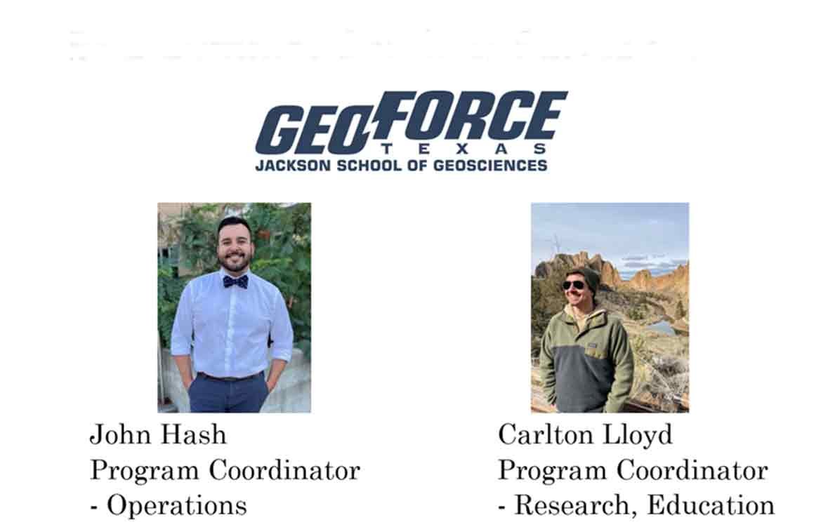
GeoFORCE

John Hash / Carlton Lloyd

RSVP to AGS Meetings HERE

GeoFORCE is an educational model that gives students from socioeconomically disadvantaged and underrepresented backgrounds an opportunity to explore STEM through Earth processes. GeoFORCE recruits talented and diverse students – rising 9th graders to students entering their first semester of college – from across Texas to participate in week-long educational academies. GeoFORCE students and staff develop cognitively, affectively, socially, and professionally through student-centered learning practices, active-learning strategies, scientific teaching, and a robust support network of staff and mentors. Due to the demographics GeoFORCE serves, GeoFORCE may be used as a model to tackle systemic, institutional, departmental, and classroom barriers for students from diverse backgrounds. GeoFORCE is a collaboration of individual donors, corporate sponsors, federal and state agencies, and academic institutions. This partnership provides an opportunity for individuals looking to assist the next generation of scientists in cultivating their sense of discovery, enhancing their self-efficacy, and developing an identity strongly aligned with the GeoFORCE experience, JSG, UT Austin, and STEM as a community.

John Hash: John is from San Antonio, Texas. He graduated from The University of Texas at Austin with a BA in Government and History. Before joining GeoFORCE, John worked with Advise TX as a College Adviser at Roosevelt HS in San Antonio, where he assisted students in SAT/ACT Prep, College Applications and Financial Aid. John has been a GeoFORCE Coordinator for over 10 summers. He is a GEAR-UP partner and leads budgeting, safety, and communication with professional mentors for the summer academies.

Carlton Lloyd: Carlton earned his BA in Geology from the University of Colorado Boulder with an emphasis on thermochronology, and his Master’s specializes in geoscience education research, specifically bridge programs (i.e., GeoFORCE). Prior to his education at CU, he served in the Marine Corps for five years as an intelligence specialist, taught as a wilderness skills instructor at a youth camp, and served as a backpacking guide in the Sierra. He has worked in STEM and youth education for over five years, ranging from 2nd grade to undergraduate students. He leads educational content development and research initiatives.

View Event →
Oct
3
6:30 PM18:30

The Lower Cretaceous Hensel-Glen Rose Stratigraphic Couplet in the Llano Uplift, Central Texas

Peter R. Rose, Ph.D., C.P.G., Founder and Senior Associate, Rose & Associates, LLP
RSVP to AGS Meetings HERE

ABSTRACT

The Lower Cretaceous Hensel Sandstone and Glen Rose Formation are lateral facies of the transgressive clastic/carbonate leg of the Trinity Division (or Group), whose stratigraphy in the area of the Llano Uplift is here mapped and characterized as a single depositional episode. The Hensel Formation represents alluvial fan, fluvial, and coastal-plain depositional settings, whereas mixed terrigenous and carbonate sediments of the overlying Glen Rose Formation represent peritidal and shallow-marine environments of deposition.

The Hensel-Glen Rose stratigraphic couplet (hence H-GR) thickens from the Llano Uplift eastward toward the Gulf of Mexico and southward toward the Rio Grande embayment. The Glen Rose lithosome thins northward to zero across the southern and eastern margins of the Llano Uplift, primarily by facies change into Hensel arkosic clastics. Reciprocally, the Hensel lithosome thins eastward and southward by grading into Glen Rose strata, so that only thin terrigenous Hensel sandstones and mudstones are present at the base of the downdip H-GR.

 At the start of H-GR deposition, the Llano Uplift was a hilly promontory projecting southeastward into the Late Aptian Gulf of Mexico and Rio Grande Embayment. Within the Uplift, the H-GR consists of poorly consolidated arkosic conglomerates, sandstones and mudstones. Its thickness varies widely due to the paleotopography of the underlying Wichita Paleoplain (hence WPP). The H-GR is thin or absent over high-standing Lower Paleozoic fault-blocks, and thick over low-standing Precambrian terranes and “mini-basins.” Hensel Sandstone thickness and configuration of the underlying WPP are mapped throughout the Llano Uplift based on such observed patterns around its margins.

 The east-flowing precursor Llano River was the primary stream draining the interior of the promontory. The eastward course of the present Llano River coincides closely with its WPP valley, even though the WPP landscape had been completely filled-in and covered by the time of early Edwards deposition. The south-flowing Kimble valley drained the southwestern quadrant of the Llano Uplift, generating thick deposits of Hensel terrigenous clastics. 

BIOGRAPHY

Peter R. Rose (BS, MA, PhD, Geology, University of Texas at Austin) is a certified petroleum geologist who was Staff Geologist with Shell Oil Company; Chief, Oil and Gas Branch of the U.S. Geological Survey; and Chief Geologist and Director of Frontier Exploration for Energy Reserves Group, Inc. (now BHP Petroleum (Americas), Inc.). In 1980, he established his own independent oil and gas consulting firm, Telegraph Exploration, Inc. His clients include most major U.S. companies and many prominent independents as well as many international firms and state oil companies. Dr. Rose has explored for oil and gas in most North American geological provinces and has published and lectured widely on U.S. resource assessment, basin analysis, play development, prospect evaluation, and risk and uncertainty in exploration. He has taught extensively at the professional level and was a 1985/1986 AAPG Distinguished Lecturer. Since 1989 he has been deeply involved in design and implementation of comprehensive exploration risk analysis systems for executive management of many major and independent oil companies, operating in both the Domestic and International theaters. His courses emphasize the link between geoscience and making money in the business of petroleum exploration. He is a Senior Associate in the consulting firm, Rose & Associates, LLP (R&A), which he founded in 2000. The firm is a recognized international leader in risk analysis of exploration and development petroleum ventures. Dr. Rose was the 1996/1997 President of the American Association of Petroleum Geologist’s Division of Professional Affairs. He received the coveted Parker Memorial Medal from the American Institute of Professional Geologists in 1998 and was awarded Honorary Membership in AAPG in 2002. He served as President of the AAPG beginning in July 2005. In 2013 he became the first American recipient of the prestigious Petroleum Group Medal of the Geological Society of London, and in 2014 AAPG honored him with its Halbouty Outstanding Leadership Award.

View Event →
Aug
29
6:30 PM18:30

Ethics and Geoscience Practice in Texas 2022

Mark N. Varhaug, P.G., C.P.G., TBPG, AAPG, Beacon Hill Energy President

RSVP to AGS Meetings HERE

Biography:

Mark N. Varhaug, P.G., C.P.G., of Dallas, serves as an appointed member of the Texas Board of Professional Geoscientists where he is Secretary/Treasurer of the Board and chairs the Application Review and Continuing Education Committee. He is also Secretary of the Southwest Section of the AAPG. Mark has more than forty-five years’ experience in the practice of geoscience in the US and internationally. He is currently President of Beacon Hill Energy, an independent exploration firm in Dallas.  

Mark received a Bachelor of Science in geology from Southern Methodist University. He is a Licensed Professional Geoscientist in Texas and Louisiana and an AAPG C.P.G.  He is a member of the Dallas, Houston, and West Texas Geological Societies; the Geological Society of America; and is a Life Member of the Society of Petroleum Engineers.  

View Event →
Jun
6
6:30 PM18:30

Geological and Techno-economic Research for a Hydrogen Economy

Dr. Mark Shuster, Associate Director: Energy Division, The Bureau of Economic Geology

RSVP to AGS Meetings HERE

Mark Shuster.jpg

Biography

Mark Shuster is responsible for managing the Bureau's energy-related research. He joined the Bureau in September, 2016. Prior to joining the Bureau, Mark worked for Shell and affiliates for 30 years in upstream oil and gas roles around the world. Mark began his professional career as a Research Geologist working on projects on the Permian Basin, Atlantic margin basins and southeast Asia. Subsequently, Mark worked on exploration and appraisal projects in Venezuela, Australia, Middle East, Gulf of Mexico and most recently, Alaska. Mark received his Bachelor of Science degree in Geology from the University of the Pacific and his PhD in Geology from the University of Wyoming.

View Event →
Apr
4
6:30 PM18:30

A Systematic Approach to Identifying Hydrocarbon Sweet Spots Using Integrated Seismic Multiattribute, Wireline-Log, and Core Analyses

Dr. Osareni (Chris) Ogiesoba, Research Scientist with the UT Bureau of Economic Geology

RSVP to AGS Meetings HERE

Presentation Summary

Dr. Ogiesoba will discuss results of an investigation conducted to determine hydrocarbon sweet spots distribution within the Campanian Taylor sandstone in Serbin field, covering 56 mi2 (~90 km2) and straddling parts of Lee, Bastrop, and Fayette Counties in southeast Texas. By integrating 3D-seismic-multiattribute analysis, neural network techniques, and core data, we demonstrate that (1) hydrocarbon sweet spots are laterally separated by mudstones and calcite- and quartz-cemented sandstones, (2) within the Taylor sandstones in Serbin field, porosity increases with depth, and (3) the Serbin field is separated into two areas: (i) a diagenetically altered, high-impedance, low-porosity rock area in the western section, and (ii) a low-impedance and relatively high-porosity sandstones area located in the eastern section.

Biography

Osareni (Chris) Ogiesoba is a Research Scientist with the Bureau of Economic Geology, Jackson School of Geosciences, The University of Texas at Austin. He holds a Ph.D. in earth and planetary sciences from McGill University, Canada, and M.Sc. in geophysics from Imperial College London, UK. Prior to joining the Bureau in 2007, Dr. Ogiesoba worked for Mobil for 19.5 years and was instrumental in the discovery more than 1 billion bbls of oil for Mobil. His research interests are in seismic interpretation, seismic attributes, inversion, and converted-wave seismic exploration. He is a member of SEG and AAPG.

View Event →
Mar
7
6:30 PM18:30

Volcanic induced mass-wasting complexes in the Upper Cretaceous (Early Campanian) Austin Chalk strata in the Maverick Basin and San Marcos Arch areas of South and Central Texas, USA

Robert G. Loucks and Robert M. Reed

RSVP to AGS Meetings HERE

Biography

Robert Loucks is a Senior Research Scientist at the Bureau of Economic Geology. He received his B.A. degree from the State University of New York at Binghamton in 1967 and his Ph.D. from the University of Texas at Austin in 1976. His general research interests include carbonate and siliciclastic sequence stratigraphy, depositional systems, diagenesis, and reservoir characterization. His latest research includes a regional investigation of the Austin Chalk producing trend. He has authored or co-authored more than 200 papers. He has twice received the Wallace E. Pratt Award for best AAPG Bulletin paper and twice received the A. I. Levorsen Award for best paper at GCSSEPM and WTGS. He was also awarded the Karst Waters Institute 2014 KWI Karst Award and the AAPG Robert R. Berg Outstanding Research Award.

View Event →
Feb
7
6:30 PM18:30

The Emerging New Geothermal Paradigm

Dr. Kenneth W. Wisian, Associate Director: Environmental Division, The Bureau of Economic Geology

RSVP to AGS Meetings HERE

Ken Wisian.jpg

Biography

Ken Wisian, Ph.D., Major General USAF (retired), is responsible for coordinating environmental related research. He came to the Bureau from the Center for Space Research. Previously, Dr. Wisian was a senior state executive responsible for disaster recovery, oil spill prevention and response, and coastal infrastructure and environmental protection for Texas. As a military officer, General Wisian participated or lead military disaster response efforts for the Shuttle Columbia crash and multiple hurricanes. Dr. Wisian is a geophysicist whose main research is in geothermal systems, modeling, and instrumentation & data analysis . Other current research includes; autonomy/drones, applied gravity, planetary geology/space exploration, infrastructure resiliency and international relations.

View Event →