Dec
4
6:30 PM18:30

Mapping fracture networks in outcrop analogs: length, aperature & connectivity, and the role of contingent nodes

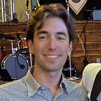
Stephanie Forstner

RSVP to AGS Meetings HERE

Stephanie is a final year Ph.D. candidate in Geosciences at UT Austin specializing in Structural Geology and Tectonics. She holds a BA in Geology from Fort Lewis College. Before her role as Research Scientist Associate II with BEG’s Fracture Research Application Consortium, Stephanie owned and operated her own oil and gas and CO2 exploration consulting firm for a handful of years. Her expertise lies in fracture network assessments and structural diagenesis, supported by her proficiency in SEM imaging and fluid inclusion analysis. Notably, her first first-author paper ­– Scale-dependent fracture networks – co-authored with PhD advisor, Dr. Steve Laubach, ranked in the Journal of Structural Geology’s top 8 most downloaded papers (for the previous 90 days) for most all of 2023. She is currently seeking post-grad school opportunities in research, exploration and development within the energy sector.

Abstract:

Using examples of regional opening-mode fractures in sandstones from the Cambrian Flathead Formation, Wyoming, we show that quartz deposits preferentially fill fractures up to ca. 0.05 mm wide and fractures transition from being mostly sealed to mostly open over a narrow size range of opening displacements from 0.05 to 0.1 mm. In our example, although isolated (I-node) dominated networks have some trace connectivity, the effective connectivity for fluid flow is likely greatly reduced by quartz cementation. Trace connectivity at microscopic and outcrop scale is similar, but most porosity is found in outcrop-scale fractures. Near faults, trace connectivity increases as initially wide porous fractures preferentially shear and wing cracks form, increasing fracture intersections (Y-nodes). However, pore space is lost due to the development of microbreccia. Macro-scale trace connectivity increases, but porous connectivity diminishes and thus potential for fluid flow is markedly lower. Connectivity descriptions should include accurate measures of widths and lengths and use nodes that reflect scale and diagenesis. We propose new rule-based node descriptions to measure diagenesis sensitive connections within the context of current field practices. Under diagenetic conditions between ca. 50˚C–250˚C differential infill makes network porosity, and thus permeability and strength, scale dependent. 

View Event →
Nov
6
6:30 PM18:30

Texas Seismicity and Seismotectonics

Currently a seismologist affiliated with the Texas Seismological Network. Have a master degree
in Marine Geophysics from the National Taiwan University and PhD in Geophysics from the State
University of New York at Binghamton. Research interest includes studying seismotectonics of
subduction zone and intraplate seismicity. Prior to the employment at the BEG, have several years of research and development experiences from the Oil & Gas industry, focusing on induced seismicity.

Abstract:

Earthquake activities in the State of Texas have significantly increased since 2008. The statewide Texas Seismological Network, better known as TexNet, was established in response to the increased seismicity and for enhancing the earthquake monitoring capacity. Studies have suggested that recent seismicity in Texas are associated with oil&gas industrial activities. Over time, seismic events were unevenly distributed throughout Texas, which have revealed previously unknown seismogenic structures across the state. Currently, a number of seismogenic zones have been identified in the greater Permian Basin (West Texas), the EagleFord Shale Play (the coastal Texas), the Fortworth Basin (central Texas), as well as several minor clusters. Earthquakes in these seismogenic zones present various rupture patterns, largely reflecting the architecture of pre-existing basemnt-rooted tectonic faults. In this presentation I will give a brief summary of these seismogenic patterns.

View Event →
Oct
2
6:30 PM18:30

The Geology of Western Sicily and Its Effect on Iron Age (2800-2900 BP) and Modern Societies

John Berry was President of the AGS in 2016-17, and is a Texas P.G.

He was Editor of The Professional Geologist (AIPG house magazine) 2017-2021. His interests include the geology of the southern Appalachians, the genesis of stratabound base metal deposits and of seepage in frontier hydrocarbon prospecting. For several years he has been helping a Swedish archaeologist to understand the interaction between the human societies of western Sicily and the area’s complex and rapidly evolving geology.

Abstract:

Western Sicily is underlain by African basement upon which is piled a series of south-verging thrust sheets (the Maghrebian Orogenic Belt) containing rocks as young as early Pleistocene.  Uplift and large earthquakes continue to the present.  Sediment loads of rivers are high, resulting in extensive alluvial plains: these were historically highly malarial, but are now drained and being de-watered by intensive irrigation. Iron Age settlements were often on the summits of high mountains, as were Arab settlements.  At other periods settlements have clustered in or near the fertile but unhealthy plains. Our project seeks to develop cheaper, more effective techniques of archaeological survey using modern remote-sensing tools. We also hope to elucidate the opportunities and limitations placed upon Iron Age and later societies by the geology of their surroundings.

View Event →
Aug
28
6:30 PM18:30

Ethics and Geoscience Practice in Texas (Video)

Mark N. Varhaug, P.G., C.P.G., TBPG, AAPG, Beacon Hill Energy President

RSVP to AGS Meetings HERE

Biography:

Mark N. Varhaug, P.G., C.P.G., of Dallas, serves as an appointed member of the Texas Board of Professional Geoscientists where he is Secretary/Treasurer of the Board and chairs the Application Review and Continuing Education Committee. He is also Secretary of the Southwest Section of the AAPG. Mark has more than forty-five years’ experience in the practice of geoscience in the US and internationally. He is currently President of Beacon Hill Energy, an independent exploration firm in Dallas.  

Mark received a Bachelor of Science in geology from Southern Methodist University. He is a Licensed Professional Geoscientist in Texas and Louisiana and an AAPG C.P.G.  He is a member of the Dallas, Houston, and West Texas Geological Societies; the Geological Society of America; and is a Life Member of the Society of Petroleum Engineers.  

View Event →
Jun
5
6:30 PM18:30

The Origin of Modern Atolls

The Origin of Modern Atolls: Challenging Darwin’s Deeply Ingrained Theory (Video)

RSVP to AGS Meetings HERE

Prof. Andre Droxler, Ph.D., Emeritus Professor
Dept. of Earth, Environmental and Planetary Sciences, Rice University

Description

In 1842, Darwin identified three types of reefs: fringing reefs, which are directly attached to volcanic islands; barrier reefs, which are separated from volcanic islands by lagoons; and ring reefs, which enclose only a lagoon and are defined as atolls. Moreover, he linked these reef types through an evolutionary model in which an atoll is the logical end point of a subsiding volcanicedifice, as he was unaware of Quaternary glaciations. 

As an alternative, starting in the 1930s, several authors proposed the antecedent karst model; in this model, atolls formed as a direct interaction between subsidence and karst dissolution that occurred preferentially in the bank interiors rather than on their margins through exposure during glacial lowstands of sea level. Atolls then developed during deglacial reflooding  of the glacial karstic morphologies by preferential stacked coral-reef growth along their margins. 

Here, a comprehensive new model is proposed (Droxler and Jorry, 2021), based on the antecedent karst model and well-established sea-level fluctuations during the last 5 million years, by demonstrating that most modern atolls from the Maldives Archipelago and from the tropical Pacific and southwest Indian Oceans are rooted on top of late Pliocene flat-topped banks. The volcanic basement, therefore, has had no influence on the late Quaternary development of these flat-topped banks into modern atolls. During the multiple glacial sea-level lowstands that intensified throughout the Quaternary, the tops of these banks were karstified; then, during each of the five mid-to-late Brunhes deglaciations, coral reoccupied their raised margins and grew vertically, keeping up with sea-level rise and creating the modern atolls. 

Recent computer based 3D numerical simulations by Liu et al. (2022) on the Quaternary development of Meiji Atoll in the southern South China Sea, based on interpreted data from a 2020-m-deep borehole drilled on its northeast rim in 2018, show that spatially differential dissolution across margin and interior areas is a critical driver of worldwide central lagoons and atoll formation.

View Event →
May
6
8:30 AM08:30

Geology Paddle on Lady Bird Lake

Please let us know if you plan to join the AGS paddle trip on Lady Bird Lake on Saturday, May 6. Participants will meet at the Rowing Dock (2418 Stratford Drive, Austin TX, 78746). Folks are welcome to bring their own boats and put in at the shore next to Rowing Dock, or rent from Rowing Dock. Meeting time will be at 8:30 am, and the dock opens at 9. There is a small dock to the side of the Rowing Dock for those who bring their own boats. Rowing Dock's rental prices are $45/day for a kayak, and $55/day for a stand-up paddle board (SUP).

Please use this survey to let us know if you plan to attend and whether or not you will need to rent a kayak from the Rowing Dock.

We are asking for a $25 per person fee to help pay for a guidebook that will be provided to attendees.

View Event →
May
1
6:30 PM18:30

Poster Session - In Person Only

Location

BEG Library
BEG Main Building, Building 130 
UT Austin, JJ Pickle Research Center
10100 Burnet Rd., Bldg 190
Austin, Texas 78758
Bureau Directions and Maps | Bureau of Economic Geology

Timeline

Meeting Time: 6:30 - 8:10 PM
Set Up and Refreshments: 6:30 to 7:00 PM
Student Recognition and Introductions: 7:00 PM
Browsing and Discussions: 7:15 to 8:00 PM

View Event →
Apr
3
6:30 PM18:30

Geoheritage & UT Seniors

RSVP to AGS Meetings HERE

Geoheritage in Texas

Geoheritage sites are areas of geologic features with significant scientific, educational, cultural, and/or aesthetic value.  These sites have the potential to advance the public understanding of science, support scientific studies, serve as outdoor classrooms, provide recreational use, and may also provide economic support to local communities.  In this presentation, we will provide an overview of Bureau of Economic Geology’s Geoheritage/GeoSign program.  We will also invite feedback and ideas for the identification of geoheritage sites in Texas. 

Linda Ruiz McCall is a geologist, educator, and business woman with experience in government service, private industry, and public education. A past AGS President, Linda holds a Bachelor of Science in Geological Sciences and a Master’s in Business Administration from The University of Texas at Austin, and a Master of Arts in Secondary Science Education from Teachers College of Columbia University.  Linda currently serves as a Program Manager for the Bureau of Economic Geology.  Her experience includes project management and communication with an emphasis on geology, water, and energy resources.  Linda currently leads the Bureau’s outreach efforts including the Geoheritage/GeoSign project. 

Charles “Chock” Woodruff, Jr. holds B.A. and M.S. degrees in geology from Vanderbilt University and a Ph.D. in geology from the University of Texas at Austin.  Chock is a past AGS President, Honorary member, and recipient of the AGS Distinguished Service Award.  He has been employed as a professional geologist in Austin for almost 50 years and is currently working for the Bureau of Economic Geology and is a Senior Lecturer in the Department of Civil, Architectural, and Environmental Engineering at U.T.  He also is self-employed as a consulting geologist in Austin.  Chock is a major contributor to the Geoheritage/GeoSign project.

Cole Carrabba: I am an undergraduate hydrogeology student at UT Austin where I will be graduating this coming May. My primary research at UT is focused on estimating the amount of tire wear pollution on the roads of central Austin, but I am truly fascinated with Texas ecology and enjoy learning about it in my free time. I am interested in working in water resource management, contaminant remediation, and coastal resilience.

Quantifying tire wear particles on Austin, Texas roads: early insights towards an overlooked source of pollution

Tires are a commonly underrepresented source of microplastic pollution. Tire tread wears throughout the lifespan of the tire, and a large portion of this material is initially deposited on the road. Large gaps in knowledge begin to exist directly after particle emission, but recent studies have shown microscopic rubber particulates in high concentrations on roadways[1]. Although the quantity of microplastics entering the environment at the road interface remains ambiguous, efforts have been made to estimate emissions in some regions of the globe[2]. In this study the quantities of tire microplastic on Austin, Texas roads were measured at several locations with a vacuum filtration system. The samples were separated by density and their plastic particles counted with a Leica M125C microscope. This dataset is the first attempt at measuring in-situ tire-wear pollution in the state of Texas. Initial counts of each sample contained an average of 1496 tire rubber particles between 70-150 μm in a 0.093 m2 area (1 ft2) of road shoulder along several Austin roads. An accurate estimation of tire wear emissions will serve as helpful preliminary information for future, upscaled research efforts. Understanding the transport pathways of microscopic pollutants will be fundamental to any form of mitigation attempt down the road.

Michael Snook is a fourth-year general geology major graduating at the end of this semester. After graduation, he plans to complete an internship with the USGS in the Cooperative Summer Field Training program before considering future graduate school plans. Although Michael’s research and academic focus has been on hydrology, he is interested in turning towards his true passion for structural geology in graduate school and beyond.

Differences in the hydration state of trees in the riparian zone of urban and rural streams in the context of urbanization and the urban heat island

The hydration state of trees can be characterized by leaf water potential (LWP), and consideration of how LWP changes on diurnal and seasonal timescales can reveal a tree’s water use strategies. Plants adjust their strategies based on meteorological inputs such as vapor pressure deficit, wind speed, insolation and latent heat partitioning, and precipitation, among others. Besides meteorological variables, antecedent conditions of the subsurface, namely soil water content and water table depth, are factors to which trees must also dynamically adjust their water use strategies to prevent hydraulic stress. This study investigates in general the differences between riparian tree hydration in urban and rural settings due to changes in local meteorology and subsurface moisture conditions brought on by urbanization, and in particular the difference in response between the two after a rainfall event. At the rural site, the most negative LWP values were seen in the mid-morning (8:00 am -11:00 am) before the rain, whereas after the rain the most negative LWP values were seen at solar noon. At the urban site, the most negative LWP values were seen at solar noon both before and after the rain event. Additionally, LWP values were found to be very strongly correlated with vapor pressure deficit, temperature, solar radiation, and relative humidity at the urban site, whereas no correlation was found to any of these values at the rural site.

Warren Wegener is a fourth-year General Geology major in the Jackson School of Geosciences. He plans on seeking a career in the mineral resources industry and will be pursuing a master’s degree focused in Economic Geology at The University of British Columbia after graduating this Spring. He is passionate about the substantial role geoscientists will hold in the coming years to find and extract the resources necessary for the looming energy transition and excited to apply this interest professionally.

Investigation into fluid transport of the Trans-Pecos alkaline intrusions: Calcite veins and their implications on the economic potential of igneous bodies of the Diablo Plateau

View Event →
Mar
6
6:30 PM18:30

Neoproterozoic-Early Paleozoic Rifting in Central Southern Laurentia -- Zircon U-Pb Geochronological Evidence from the Devils River Uplift, West Texas, USA

RSVP to AGS Meetings HERE

Pat Dickerson, Ph.D

Pat is a Visiting Research Fellow with the Jackson School of Geosciences and the American Geosciences Institute

Reconstructing the tectonic history of southwestern Laurentia is Dickerson’s research focus: seeking the diagnostic evidence for Rodinia assembly and fragmentation (West Texas, Argentine Precordillera), Pangaea amalgamation (Marathon/Solitario fold-thrust belt, Ancestral Rocky Mts.), Laramide foreland deformation (Big Bend), and Rio Grande riftng/transform faulting. Research sponsors include NPS and NASA. She draws from those investigations in leading geological and natural history field seminars for students and professional scientists, as well as for Smithsonian groups. Pat has also served on task forces to develop scientific strategies for exploring the Moon and Mars. Based in the UT Walter Geology Library, her current professional service work is with the GeoRef geosciences database project of the American Geosciences Institute.

ABSTRACT

An essential tectonostratigraphic complex for assessing the timing and mode of Rodinia breakup in central southern Laurentia is the Devils River Uplift, a Laurentian Grenville basement-cored block in the subsurface of west Texas, which was severed during Cryogenian-early Cambrian rifting, then thrust back onto the southern margin during late Paleozoic collisional orogenesis. Zircon U/Pb geochronological data from Mesoproterozoic to upper Cambrian metamorphic and sedimentary strata cored in the uplift significantly extend the record of Cryogenian onset of intraplate extensional magmatism, as well as early Cambrian igneous activity, in the region.

Results of LA-ICP-MS analyses place formation of the basement orthogneisses at 1230 Ma. Younger Grenvillian detritus (~1070 Ma) is common in lower to middle Cambrian metasediments and predominates in upper Cambrian sandstones. Lower to middle Cambrian units yielded abundant Cryogenian grains (780 to 700 Ma) reflecting early-phase rifting. Also recovered from those intervals were plentiful zircons indicative of late Neoproterozoic to early Cambrian (580 to 520 Ma) rift magmatism. Volcanic clasts and detritus of like ages have been dated from Cambrian and Ordovician sedimentary rocks in the Marathon/Solitario basin, ~75 km farther west. Episodic Neoproterozoic to early Paleozoic rifting is thus increasingly documented on the central southern Laurentian margin.

Devils River Uplift geochronologic data enable direct comparison with potential counterparts in the Cuyania terrane, which rifted away from the Marathon-Ouachita Embayment of southern Laurentia and is now an element of the Andes of western Argentina. Clear correlatives confirm the shared pre-rift and rift history of DRU and the conjugate Cuyania block from Mesoproterozoic through mid-Cambrian time.

View Event →
Feb
6
6:30 PM18:30

Potential Utilization of Salt Caverns for Brine Production Liquified Petroleum Gas (LPG) and Natural Gas Storage in the Permian Basin

Harold Rogers is the GIS team lead for the State of Texas Advanced Resource Recovery Group (STARR) at the Bureau of Economic Geology. Along with helping STARR with various GIS projects, Harold uses his skills in subsurface modeling, well analysis, animation, and visualization to assist a variety of Bureau research groups. He holds a Bachelor of Science degree in Radio-Television-Film and a Bachelor of Arts degree in Studio Art from the University of Texas at Austin and a Master’s in Geospatial Information Science and Technology from North Carolina State University. Harold has been working in the field of GIS for 15 years and the Bureau of Economic Geology for over 10 years.

Abstract:

Salt caverns are increasingly considered for fluid storage in the Permian Basin of Texas. The types of fluids considered for salt cavern storage include: oil field wastes, natural gas, condensate and brine. Salt formations provide a temporary home for products needed for consumption on a daily basis. Salt caverns are stable with respect to injection and withdraw cycles so they can accommodate a wide variety of energy resources. The storage capacity can be large enough for temporary storage, seasonal reserves, or strategic reserves. In this study, we present the advantages and disadvantages of three candidates for salt cavern storage potential. We use publicly available data as well as data from the Bureau of Economic Geology.

Through fractionation of the natural gas liquids and the liquid petroleum gas different products are stored underground for fuel and feedstock for power plants, refineries, homes and businesses. Operators have to carefully monitor liquid saturation to prevent salt caverns increasing in size causing salt creep, cavern roof collapse or uncontrolled leaching into water supplies.

Oil field wastes that are most troublesome to dispose of through regular class II injection are good candidates for salt caverns. There are three options for storing natural gas, condensate, brine and potentially hydrogen in the US. These include (1) depleted oil fields, (2) salt formations, and (3) depleted aquifers. Salt formations can either be as deep and narrow or bedded making them wide and shallow. Depleted aquifers can be converted for storage of natural gas liquids by injection at high pressure both utilizing the permeable rock formations as overburden and the water of varying quality as containment.

View Event →